Wake Forest Digital Twin
Walk through downtown Wake Forest before the new buildings exist.
An immersive Unreal Engine digital twin of downtown Wake Forest, North Carolina, built from the Town’s GIS data. With Esri’s Vitruvio plugin, building footprints can be edited live while it runs, so residents could see proposed heights and redevelopment from the street and tell planners what they thought.
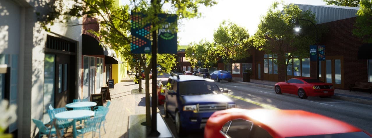
Street level in the digital twin. Images: Town of Wake Forest Downtown Plan (2024).
2026
Esri Special Achievement in GIS Award, to the Town and Houseal Lavigne
3–10
storey building heights residents could compare
7
downtown subareas with clear development expectations
2024
Downtown Plan adopted, with the twin as one of its four parts
Award
Esri Special Achievement in GIS Award, 2026
Esri recognized the Town of Wake Forest and Houseal Lavigne Associates in the Community Planning and Economic Development category. The award honours the project as a whole: the planning, analysis, community engagement and the digital twin together.
I was one member of a larger team. My part was the immersive digital twin; the planning work and the award belong to everyone who built this project.
See Esri’s list of winnersThe challenge
Height and density are hard to picture on a map
After finishing a community-wide plan, Wake Forest’s planners kept hearing the same questions about downtown: how tall could new buildings get, how dense would it feel, and would it still look like Wake Forest? Downtown’s terrain makes this harder, with grade changes of 20 to 25 feet within a few blocks.
As part of the 2024 Downtown Plan, the project team built an immersive digital twin of the study area, from Roosevelt Avenue to Taylor Street and from Elm Avenue to the railroad. It deliberately left out façade materials and architectural style, so conversations stayed on what the plan could actually decide: height, setbacks, transitions, views and scale.
Inside the twin
Existing downtown, then the proposals, side by side
Proposed buildings appear as simple yellow massing, so residents judged height and scale rather than architecture.
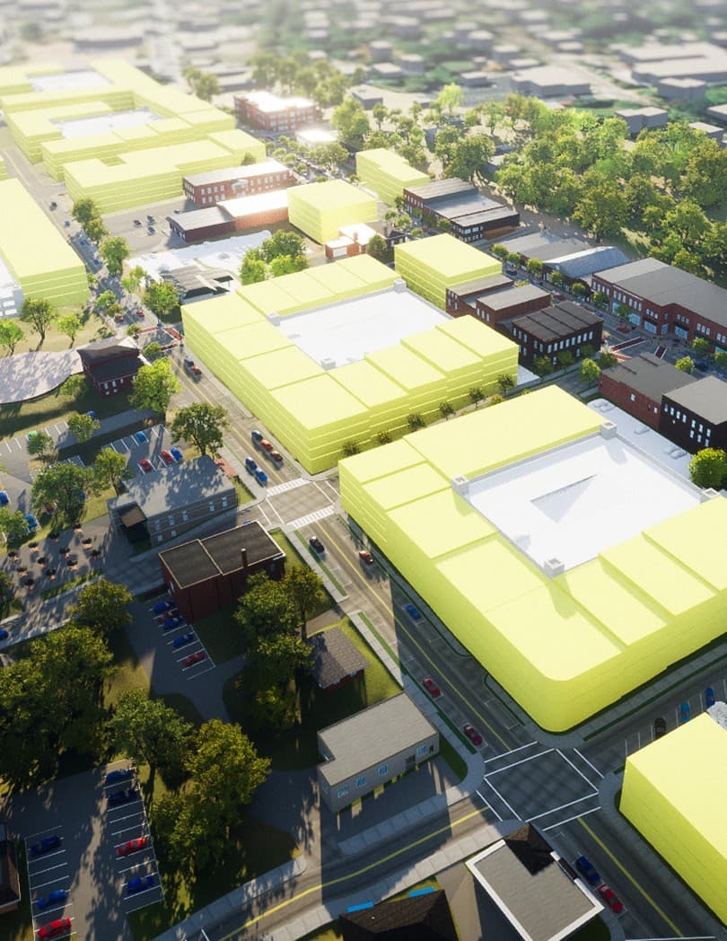
From above
An aerial view with proposed redevelopment shown as massing around the historic core.
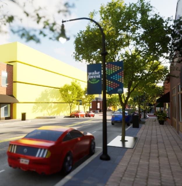
At street level
The same proposals from the sidewalk, at the height a resident would actually see them.
Community Open House
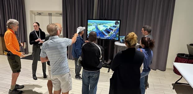
Residents took the controller
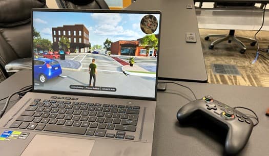
At the Community Open House, people explored the twin themselves in a third-person view, with an Xbox controller on ordinary screens.
- Walk or fly through downtown from pedestrian and aerial viewpoints
- Switch between existing conditions and future scenarios
- Toggle redevelopment options and compare building heights of three, five, eight and ten storeys
- Give feedback directly to the project team while standing in the scene
Live procedural buildings
Edit a footprint, and the building rebuilds itself
The twin uses Vitruvio, Esri’s CityEngine plugin for Unreal Engine. It runs CityEngine’s procedural CGA rules inside Unreal, so buildings are generated from their footprints and attributes while the twin is running, not baked in ahead of time.
- Building footprints can be edited live during runtime, and the model regenerates on the spot
- The CityEngine rule packages from the planning model drive the buildings in Unreal, instead of exporting them as static meshes
- Heights and massing change through rule parameters rather than new 3D models, which suits quick side-by-side scenarios
The pipeline
- 01CityEngineCGA rules describe how a footprint becomes a building
- 02Rule packageThe rules are exported as an RPK
- 03VitruvioUnreal runs the RPK and generates buildings at runtime
- 04Live editChange a footprint or height, and the building updates
How it was built
From the Town’s GIS data to an interactive downtown
01
Analyze
ArcGIS Pro analysis of land use, streets, slopes, block sizes, ownership and reuse opportunities.
02
Model
The Town’s GIS data built into a detailed 3D model of downtown’s terrain and buildings with ArcGIS CityEngine.
03
Immerse
The model brought into Epic’s Unreal Engine, with Vitruvio generating the buildings live from CityEngine rules.
04
Engage
Residents explored it at the Community Open House and gave feedback on heights and redevelopment.
Outcomes
What the twin fed into
According to Esri, insights from the digital twin directly informed the Town’s decisions.
Zoning and the UDO
Updates to the zoning code and the Unified Development Ordinance.
Seven subareas
Clear development expectations across downtown’s seven functional subareas.
Height and massing
Guidelines that respect the scale and character of the historic district.
Connections
Priority pedestrian and vehicular connections identified across downtown.
The Downtown Plan itself, adopted in 2024, also received a 2025 APA-NC Marvin Collins Award for Small Area Plan.
Coverage
Read more about the project
See the whole plan
The Downtown Plan covers land use, parking, market analysis and the digital twin. Esri’s case study tells the story of how the twin was used.